National Center for Seismology
Ministry of Earth Sciences
Government of India
Ministry of Earth Sciences
Government of India
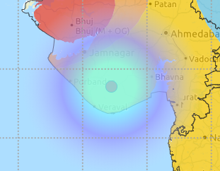
| Origin Time | : 2021-05-15 05:09:53 (IST) |
|---|---|
| Lat, Long | : 26.28, 95.26 |
| Magnitude | : 4.2 |
| Depth | : 81km |
| Event Status | : Reviewed |